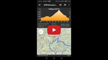
WRPElevationChart is a streamlined application designed to help users create and visualize elevation profiles from GPS-based data. This tool is particularly appealing to outdoor enthusiasts who wish to see accurate visual representations of their hiking, cycling, or running routes.
The primary function of the app is the generation of 2D and 3D elevation charts, providing immediate insights into the terrain's inclines and declines based simply on distance and elevation data. Users can effortlessly import GPS tracks from GPX, TCX, KML, KMZ, and FIT files, syncing these with the map view for a comprehensive geographical understanding.
Another key feature is its in-app conversion capability, where GPS data can be internally transformed into GPX format, facilitating easy sharing with other applications. For avid Garmin users, the app streamlines the transition of route data to the Garmin Connect app.
Effective file management is supported through an integrated browser mode, allowing users to sift through their files conveniently, a welcome feature since Android 11's restrictions on accessing certain device folders.
Additional features include the ability to:
- Enter custom distance and altitude values.
- Quickly calculate slope percentages.
- Assign titles to elevation charts.
- Select metric or imperial units for chart axes.
- Save and restore profile data in XML format.
- Compute ascent and descent metrics with an adjustable hysteresis factor.
- View tracks on a map and animate them for a virtual ride experience.
- Compatibility with the ‘GPS Logger’ app, enhancing its utility.
- Enhanced sharing functions for efficient data transfer to compatible apps.
- Options to display a speed curve and autoscaling for the elevation chart.
- The ability to export GPX and KML files for use in applications like Google Earth.
A standout addition is the 3D GPS track elevation chart, which emulates the sophisticated views found in specialized Windows programs.
Be aware that the app requires specific permissions to operate optimally, including write/read access for data storage and creating shareable screenshot graphics, as well as location data to hone in on your current location in the map view. Internet permissions are also needed to download map tiles, thus a stable Wi-Fi connection or mobile data plan is recommended to prevent additional costs.
In summary, WRPElevationChart offers a direct and user-friendly approach to managing and reviewing GPS route data, equipped with functional and adaptable features, it stands as a valuable tool for tracking and sharing outdoor adventures.
Requirements (Latest version)
- Android 5.0 or higher required


Comments
There are no opinions about WRPElevationChart yet. Be the first! Comment